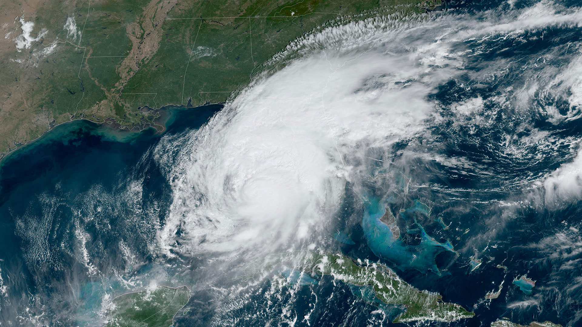
HURRICANE Milton has made landfall in Florida’s Gulf Coast as parts of the state brace for the superstorm’s potential 10 to 15 feet of life-threatening tide.
The catastrophic storm is expected to bring intense rainfall and powerful winds of up to 155 mph, placing nearly 20 million residents in west-central Florida under a hurricane and tropical storm warning.
16

16

16

16

16

16

16

16
The US National Hurricane Center says the hurricane has maximum sustained winds of 120mph.
Forecasters said that widespread flooding with heavy rainfall of 12 to 16 inches could strike the Tampa area.
“The track of Hurricane Milton continues to be a worst-case scenario for Tampa Bay region southward to Charlotte,” the National Weather Service in Tampa Bay said Wednesday.
State lawmakers fear Milton will be one of the worst and most destructive hurricanes in Florida in 100 years.
In the days leading up to the storm’s arrival, millions across west-central Florida stocked up their vehicles with essential items and personal belongings, driving north or south away from Milton’s intimidating path.
Eerie videos circulating on social media showed dozens of abandoned communities, many of which are still in ruins from the onslaught of Hurricane Helene two weeks ago.
In Gulfport, police drove slowly through a debris-riddled neighborhood, playing a recording on the loudspeaker informing residents of a mandatory evacuation, according to a video by reporter Brian Entin on X.
Mandatory evacuation orders are in place for 13 counties in Florida, including Sarasota, Hillsborough, and Volusia.
Aerial images showed Interstate 75’s northbound lane jam-packed with bumper-to-bumper traffic as hundreds of terrified residents fled their homes to seek shelter.
It comes as…
‘SIGNIFICANT COASTAL CHANGE’
Scientists at the US Geological Survey fear that when it is all set and done, Milton will completely change Florida’s west coastline forever.
“The significance of the coastal change forecast for Milton’s impact to the Florida west coast cannot be overstated as I believe communities are more vulnerable to this storm’s impacts due to the erosion that occurred recently from Helene,” Kara Doran, a USGS scientist, said.
“Our initial analysis looking at imagery collected by the National Oceanic and Atmospheric Administration after Helene shows most of the west coast experienced overwash or inundation and complete erosion of dunes, so those protective dunes are no longer in place for many locations.”
Experts predict Milton’s ferocious storm surge could cause 95% to 100% of Florida’s west coast beaches to experience erosion and overwash.
Overwash occurs when water levels reach higher than the top of the dunes.
When a beach is overwashed, sand can be pushed and deposited inland, causing significant changes to coastal landscapes and blocking roadways, according to the USGS.

16

16

16

16
‘WHISKER SHY’ OF CATEGORY 5
Florida Governor Ron DeSantis described Milton as “just a whisker shy” of Category 5.
“While there is the hope that it will weaken more before landfall, there is high confidence that this hurricane is going to pack a major, major punch and do an awful lot of damage,” DeSantis told reporters on Wednesday.
Hours before Milton’s neared landfall, the storm spawned at least 10 tornados across southcentral Florida.
The National Hurricane Center called the uncanny advisory a “tornadic supercells from Milton.”
“The time to prepare, including evacuate, is quickly coming to an end along the Florida west coast,” the National Hurricane Center warned on Wednesday.
Florida is still reeling from the aftermath of Hurricane Helene in late September, which has left over 220 people dead across the southeast United States.

16

16

16

16
What is a hurricane and how do they form?
A HURRICANE is another name for a tropical cyclone – a powerful storm that forms over warm ocean waters near the equator.
Those arising in the Atlantic or eastern Pacific are called hurricanes, while those in the western Pacific and Indian Ocean are dubbed typhoons or cyclones.
North of the equator they spin anticlockwise because of the rotation of the Earth, however, they turn the opposite way in the southern hemisphere.
Cyclones are like giant weather engines fuelled by water vapor as it evaporates from the sea.
Warm, moist air rises away from the surface, creating a low-pressure system that sucks in air from surrounding areas – which in turn is warmed by the ocean.
As the vapour rises it cools and condenses into swirling bands of cumulonimbus storm clouds.
The system grows and spins faster, sucking in more air and feeding off the energy in seawater that has been warmed by the sun.
At the center, a calm “eye” of the storm is created where cooled air sinks towards the ultra-low pressure zone below, surrounded by spiraling winds of warm air rising.
The faster the wind, the lower the air pressure at the center, and the storm grows stronger and stronger.
Tropical cyclones usually weaken when they hit land as they are no longer fed by evaporation from the warm sea.
But they often move far inland – dumping vast amounts of rain and causing devastating wind damage – before the “fuel” runs out and the storm peters out.
Hurricanes can also cause storm surges when the low air pressure sucks the sea level higher than normal, swamping low-lying coasts.
More to follow… For the latest news on this story, keep checking back at The U.S. Sun, your go-to destination for the best celebrity news, sports news, real-life stories, jaw-dropping pictures, and must-see videos.
Like us on Facebook at TheSunUS and follow us on X at @TheUSSun


